LabLynx Wiki
Voorkoms
Fukushima Prefektuur
| Onderdeel van | Tohoku streek |
|---|---|
| Datum van stigting of ontstaan | 21 Augustus 1876 |
| Naam in kana | ふくしまけん |
| Archives at | Fukushima Prefectural Archives |
| Vernoem na | Fukushima Castle |
| Volkslied | Fukushima-ken Kenmin no Uta |
| Land | Japan |
| Hoofstad | Fukushima |
| Geleë in administratiewe eenheid | Japan |
| Geleë in tydsone | UTC+09:00, Japan Standaardtyd |
| Geografiese ligging | 37°45′1″N 140°28′4″E |
| Geoshape | Data:Japan/Fukushima.map |
| Hoogste punt | Mount Hiuchigatake |
| Kantoor gehou deur hoof van die regering | governor of Fukushima Prefecture |
| Hoof van plaaslike regering | Masao Uchibori |
| Uitvoerende liggaam | Fukushima prefekturale regering |
| Wetgewende gesag | Fukushima Prefectural Assembly |
| Wettige vorm | ordinary local public entity |
| Vervang | Fukushima Domain, Nihonmatsu Domain, Shirakawa Prefecture, Wakamatsu Prefecture, Iwasaki Prefecture |
| Belangrike gebeurtenis | Aftermath of the 2011 Tōhoku earthquake and tsunami, 2011 Tōhoku aardbewing en tsunami, Fukushima Daiichi nuclear disaster |
| Dag in jaar | 21 Augustus |
| Mascot | Kibitan |
| Amptelike webwerf | https://www.pref.fukushima.lg.jp/, http://www.pref.fukushima.lg.jp/site/portal-es/ |
| Vlag | flag of Fukushima prefecture |
| Official symbol | Rhododendron brachycarpum f. nemotoanum, Narcissus Flycatcher, Zelkova serrata |
| Ekonomie van onderwerp | economy of Fukushima prefecture |
| Catchphrase | うつくしま |
| Category for the view of the item | Category:Views of Fukushima prefecture |
| Kategorie vir kaarte | Category:Maps of Fukushima prefecture |


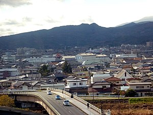
Fukushima-prefektuur (福島県 Fukushima-ken?) is een van die 47 prefekture van Japan. Fukushima is die hoofstad en belangrikste stedelike gebied.


