Type a search term to find related articles by LIMS subject matter experts gathered from the most trusted and dynamic collaboration tools in the laboratory informatics industry.
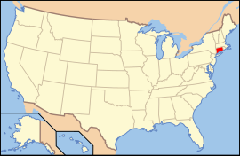
| State of Connecticut | |||||
| |||||
| Ìlàjẹ́: The Constitution State; The Nutmeg State; The Provisions State[1] | |||||
| Motto(s): Qui transtulit sustinet.[1] (Latin) | |||||
 | |||||
| Èdè oníibiṣẹ́ | De jure: None De facto: English | ||||
| Orúkọaráàlú | Connecticuter,[2] Nutmegger[3] | ||||
| Olúìlú | Hartford | ||||
| Ìlú atóbijùlọ | Bridgeport[4] | ||||
| Largest metro area | Greater Hartford[5] | ||||
| Àlà | Ipò 48th ní U.S. | ||||
| - Total | 5,543 sq mi (14,356 km2) | ||||
| - Width | 70 miles (113 km) | ||||
| - Length | 110 miles (177 km) | ||||
| - % water | 12.6 | ||||
| - Latitude | 40°58′ N to 42°03′ N | ||||
| - Longitude | 71°47′ W to 73°44′ W | ||||
| Iyeèrò | Ipò 29th ní U.S. | ||||
| - Total | 3,501,252 (2008 est.)[6] 3,405,565 (2000) | ||||
| - Density | 702.9/sq mi (271.40/km2) Ranked 4th in the U.S. | ||||
| - Median income | $55,970 (4th) | ||||
| Elevation | |||||
| - Highest point | South slope of Mount Frissell[7] Note: The summit of Mount Frissell is in Massachusetts 2,380 ft (726 m) | ||||
| - Mean | 500 ft (152 m) | ||||
| - Lowest point | Long Island Sound[7] sea level | ||||
| Admission to Union | January 9, 1788 (5th) | ||||
| Gómìnà | Dannel Malloy (D) | ||||
| Ìgbákejì Gómìnà | Michael Fedele (R) | ||||
| Legislature | {{{Legislature}}} | ||||
| - Upper house | {{{Upperhouse}}} | ||||
| - Lower house | {{{Lowerhouse}}} | ||||
| U.S. Senators | Christopher Dodd (D) Joe Lieberman (ID) | ||||
| U.S. House delegation | 5 Democrats (list) | ||||
| Time zone | Eastern: UTC-5/-4 | ||||
| Abbreviations | CT Conn. US-CT | ||||
| Website | ct.gov | ||||
Ipinle Konnektikot

|
Àyọkà yìí tàbí apá rẹ̀ únfẹ́ àtúnṣe sí. Ẹ le fẹ̀ jù báyìí lọ tàbí kí ẹ ṣàtúnṣe rẹ̀ lọ́nà tí yíò mu kúnrẹ́rẹ́. Ẹ ran Wikipedia lọ́wọ́ láti . |
<ref> tag; no text was provided for refs named SOTS