Type a search term to find related articles by LIMS subject matter experts gathered from the most trusted and dynamic collaboration tools in the laboratory informatics industry.
| National Route 121 | |
|---|---|
| Ruta nacional 121 | |
 | |
| Route information | |
| Maintained by Mercovias | |
| Length | 8.3 km (5.2 mi) |
| Existed | 1997–present |
| Major junctions | |
| W end | National Route 14 |
| E end | Brazilian border |
| Location | |
| Country | Argentina |
| Highway system | |
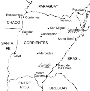
National Route 121 is a national road in Argentina, running East in Corrientes. In its 8.3 kilometres (5 mi) paved length, it joins Km 683 marker of National Route 14, near the town of Santo Tomé and the Puente de la Integración ("Integration Bridge") of 1,403 metres (4,603 ft) over the Uruguay River crossing the border into Brazil to the town of São Borja.
The road was built in 1997 by the Mercovias company along with the international bridge in a 25-year public lease.