Type a search term to find related articles by LIMS subject matter experts gathered from the most trusted and dynamic collaboration tools in the laboratory informatics industry.
Hradčany | |
|---|---|
Cadastral Area of Prague | |
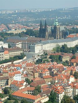
 Hradčany from the Petřín Tower | |
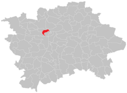
 Location of Hradčany in Prague | |
| Coordinates: 50°05′29″N 14°23′50″E / 50.09139°N 14.39722°E | |
| Country | Czech Republic |
| Region | Prague |
| District | Prague 1, Prague 6 |
| Area | |
• Total | 1.51 km2 (0.58 sq mi) |
| Population (2021)[1] | |
• Total | 1,774 |
| • Density | 1,200/km2 (3,000/sq mi) |
| Time zone | UTC+1 (CET) |
| • Summer (DST) | UTC+2 (CEST) |
Hradčany (Czech pronunciation: [ˈɦratʃanɪ] ; German: Hradschin), is the district of the city of Prague, Czech Republic surrounding Prague Castle.
The castle is one of the biggest in the world[2] at about 570 metres (1,870 feet) in length and an average of about 130 metres (430 feet) wide. Its history stretches back to the 9th century. St Vitus Cathedral is located in the castle area.
Most of the district consists of noble historical palaces. There are many other attractions for visitors: romantic nooks, peaceful places and beautiful lookouts.
Hradčany was an independent borough until 1784, when the four independent boroughs that had formerly constituted Prague were proclaimed a single city. The other three were Malá Strana (German: Kleinseite, Lesser Quarter), Staré Město (German: Altstadt, Old Town) and Nové Město (German: Neustadt, New Town).
| Year | Pop. | ±% |
|---|---|---|
| 1869 | 5,940 | — |
| 1880 | 12,330 | +107.6% |
| 1890 | 12,584 | +2.1% |
| 1900 | 12,906 | +2.6% |
| 1910 | 10,580 | −18.0% |
| 1921 | 10,732 | +1.4% |
| 1930 | 9,100 | −15.2% |
| 1950 | 8,203 | −9.9% |
| 1961 | 6,154 | −25.0% |
| 1970 | 4,590 | −25.4% |
| 1980 | 3,464 | −24.5% |
| 1991 | 2,797 | −19.3% |
| 2001 | 2,313 | −17.3% |
| 2011 | 2,079 | −10.1% |
| 2021 | 1,774 | −14.7% |
| Source: Censuses[3][1] | ||