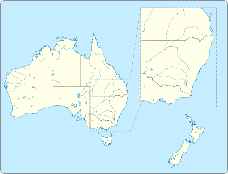
Original file (SVG file, nominally 1,205 × 918 pixels, file size: 577 KB)
File history
Click on a date/time to view the file as it appeared at that time.
| Date/Time | Thumbnail | Dimensions | User | Comment | |
|---|---|---|---|---|---|
| current | 12:46, 24 April 2022 |  | 1,205 × 918 (577 KB) | Goran tek-en | changed colors and types of lines |
| 15:47, 19 April 2022 |  | 1,205 × 918 (561 KB) | Goran tek-en | added territories Australia requested by Alextigers | |
| 17:29, 2 May 2015 |  | 1,505 × 1,147 (716 KB) | Goran tek-en | Removed a lake as it was not a lake. | |
| 09:59, 24 March 2015 |  | 1,505 × 1,147 (719 KB) | Goran tek-en | User created page with UploadWizard |
File usage
The following 62 pages use this file:
- 2005–06 A-League
- 2006–07 A-League
- 2007–08 A-League
- 2008–09 A-League
- 2009–10 A-League
- 2010–11 A-League
- 2011–12 A-League
- 2012–13 A-League
- 2013–14 A-League
- 2014–15 A-League
- 2015–16 A-League
- 2015–16 National Youth League (Australia)
- 2016–17 A-League
- 2016–17 National Youth League (Australia)
- 2017–18 A-League
- 2017–18 Y-League
- 2018–19 A-League
- 2019–20 A-League
- 2020–21 A-League
- 2021–22 A-League Men
- 2021–22 NBL season
- 2022–23 A-League Men
- 2022–23 NBL season
- 2023–24 A-League Men
- 2023–24 A-League Women
- 2023–24 NBL season
- 2024–25 A-League Men
- 2024–25 A-League Women
- 2024–25 NBL season
- A-League Men
- A-League Women
- A-League Youth
- Expansion of the A-League Men
- List of A-League Men clubs
- National Basketball League (Australia)
- User:2 brown eyes/Australian Football League
- User:Dpt8544/aleague sandbox
- User:Dpt8544/map sandbox
- User:J man708/Template:A-League 2005-2007 map
- User:J man708/Template:A-League 2007-2009 map
- User:J man708/Template:A-League 2009-2010 map
- User:J man708/Template:A-League 2010-2011 map
- User:J man708/Template:A-League 2011-2012 map
- User:J man708/Template:A-League 2012-2014 map
- User:J man708/Template:A-League 2014-2017 map
- User:Mattsalt77/sandbox
- Wikipedia:Graphics Lab/Map workshop/Archive/March 2015
- Template:A-League 2005–2007 map
- Template:A-League 2007–2009 map
- Template:A-League 2009–2010 map
- Template:A-League 2010–2011 map
- Template:A-League 2011–2012 map
- Template:A-League 2012–2014 map
- Template:A-League 2014–2019 map
- Template:A-League 2019–2020 map
- Template:A-League 2020–2024 map
- Template:A-League 2024–2025 map
- Template:A-League expansions map
- Template:Map of A-League Teams
- Template:NBL map
- Template:NYL all clubs map
- Template:W-League all clubs map
Global file usage
The following other wikis use this file:
- Usage on af.wikipedia.org
- Usage on id.wikipedia.org
- Usage on it.wikipedia.org
- Usage on ko.wikipedia.org
- Usage on ms.wikipedia.org
- Usage on pl.wikipedia.org
- Usage on ro.wikipedia.org
- Usage on simple.wikipedia.org
- Usage on th.wikipedia.org
- Usage on vi.wikipedia.org
- Usage on zh.wikipedia.org


