Effects of the storage conditions on the stability of natural and synthetic cannabis in biological matrices for forensic toxicology analysis: An update from the literature

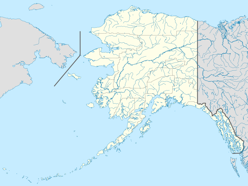
Tibuok resolusyon (SVG nga payl, nominally 1,553 × 1,160 pixels, size sa payl: 1.24 MB)
Kaagi sa payl
I-klik ang petsa/oras aron makit-an ang hulagway sa payl niadtong panahona.
| Petsa/Takna | Thumbnail | Mga dimensyon | Tiggamit | Komento | |
|---|---|---|---|---|---|
| kasamtangan | 19:13, 3 Oktubre 2009 |  | 1,553 × 1,160 (1.24 MB) | Alexrk2 | Linien gesäubert |
| 19:03, 3 Oktubre 2009 |  | 1,553 × 1,160 (1.25 MB) | Alexrk2 | Westlicher Teil korrigiert | |
| 18:35, 3 Oktubre 2009 |  | 1,553 × 1,160 (1.24 MB) | Alexrk2 | == Beschreibung == {{Information |Description= {{de|Positionskarte von Alaska, USA}} Quadratische Plattkarte, N-S-Streckung 210.0 %. Geographische Begrenzung der Karte: * N: 72.0° N * S: 51.0° N * W: 188.0° W * O: 129.0° W { |
Mga paggamit sa payl
More than 100 pages use this file. The following list shows the first 100 pages that use this file only. A full list is available.
- Abraham Valley
- Admiralty Island
- Aga Cove
- Agattu Island
- Akuchin Rocks
- Alexai Beach
- Alexai Creek
- April Inlet
- Artillery Hill (bukid sa Tinipong Bansa, Alaska)
- Artist Creek (suba sa Tinipong Bansa, Alaska)
- Attu Island
- Autumn Bight
- Ballentine Creek
- Bamboo Bay (luuk sa Tinipong Bansa)
- Barley Cove (luuk)
- Birch Beach (lapyahan sa Tinipong Bansa)
- Bird Rock (pulo sa Tinipong Bansa, Alaska, Aleutians West Census Area)
- Black Mountain (bukid sa Tinipong Bansa, Alaska, Aleutians West Census Area)
- Blonde Cove
- Bogoslof Canyon
- Broad Beach (lapyahan sa Tinipong Bansa)
- Brunette Cove
- Buchanan Ridge (tagaytay sa Tinipong Bansa, Alaska)
- Casco Cove
- Chichagof Harbor
- Chichagof Point
- Chirikof Beach
- Chirikof Point
- Chitka Cove
- Chugul Point
- Chuniksak Point
- Clam Point (punta sa Tinipong Bansa, Alaska, Aleutians West Census Area, lat 51,41, long 179,16)
- Cobra Peninsula
- Cornfield Ridge
- Crater Bay (luuk sa Tinipong Bansa, Alaska, Aleutians West Census Area)
- Cyril Cove
- Dark Cove (luuk sa Tinipong Bansa, Alaska)
- Diehm Creek (suba sa Tinipong Bansa, lat 52,91, long 173,98)
- East Massacre Valley
- East Point (punta sa Tinipong Bansa, Alaska, Aleutians West Census Area)
- Ethel Cove
- Fan Mountain (bukid sa Tinipong Bansa, Alaska, Aleutians West Census Area)
- Far Hill (bukid)
- Fawn Hill (bukid sa Tinipong Bansa, Alaska)
- Fin Creek (suba sa Tinipong Bansa, Alaska, Aleutians West Census Area)
- Fox Beach (lapyahan sa Tinipong Bansa, Alaska)
- Fox Hill (bukid sa Tinipong Bansa, Alaska, Aleutians West Census Area, lat 51,93, long 177,32)
- Fruit Hill (bukid sa Tinipong Bansa, Alaska)
- Fur Mountain (bukid sa Tinipong Bansa, Alaska)
- Good Creek (suba sa Tinipong Bansa, Alaska)
- Holtz Bay
- Hoosier Hill (bukid sa Tinipong Bansa, Alaska)
- Karab Cove
- Kennon Island
- Khlebnikof Point
- Khvostof Pass
- Knob Hill (bukid sa Tinipong Bansa, Alaska, Aleutians West Census Area)
- Lance Hill
- Lard Hill
- Lean Hill
- Lick Creek (suba sa Tinipong Bansa, Alaska, Aleutians West Census Area)
- Loot Hill
- Lousy Hill
- Lug Point
- Mangy Hill
- Maniac Hill
- Massacre Bay (luuk sa Tinipong Bansa, Alaska)
- Matthews Mountain (bukid sa Tinipong Bansa, Alaska)
- McArthur Reef (kagaangan)
- Midden Cove
- Midden Point
- Mike Hill
- Milton Creek (suba sa Tinipong Bansa, Alaska)
- Monument Hill (bukid sa Tinipong Bansa, Alaska)
- Navy Cove (luuk sa Tinipong Bansa, Alaska)
- Nazi Creek
- North-northwest Bight
- North Ridge (tagaytay sa Tinipong Bansa, Alaska)
- Novatak Glacier
- Petrel Point (punta sa Tinipong Bansa, Alaska, Aleutians West Census Area, lat 51,49, long 179,09)
- Pochnoi Point
- Point Poker
- Red Bluff (pangpang sa Tinipong Bansa, Alaska, Aleutians West Census Area, lat 52,08, long 177,66)
- Rex Hill (bukid sa Tinipong Bansa, Alaska)
- Rim Point
- Rucksock Creek
- Russian Ridge (tagaytay sa Tinipong Bansa, Alaska)
- Salt Creek (suba sa Tinipong Bansa, Alaska, Aleutians West Census Area)
- Sarana Bay (luuk sa Tinipong Bansa, Aleutians West Census Area)
- Siddens Valley
- Silver Salmon Lake (lanaw sa Tinipong Bansa, Aleutians West Census Area)
- Smith Beach (lapyahan sa Tinipong Bansa, Alaska)
- Sonom Beach
- Southeast Point (punta sa Tinipong Bansa, Alaska, Aleutians West Census Area, lat 51,92, long 179,73)
- Southwest Indent
- Square Point (punta sa Tinipong Bansa, Alaska, Aleutians West Census Area)
- Tanadak Pass
- Temnac Bay
- Thirty-Seven Hill
- Tropical Ridge
View more links to this file.
Global nga paggamit sa payl
Kining ubang wiki naggamit ning maong payl:
- Paggamit sa af.wikipedia.org
- Paggamit sa als.wikipedia.org
- Paggamit sa an.wikipedia.org
- Paggamit sa ar.wikipedia.org
- Paggamit sa ast.wikipedia.org
- Alaska
- Baranof
- Juneau (Alaska)
- Anchorage (Alaska)
- Fairbanks (Alaska)
- Ninilchik (Alaska)
- Islles Aleutianes
- Kodiak (Alaska)
- Golfu d'Alaska
- Monte Denali
- Parque y Reserva Nacionales de les Puertes del Árticu
- Cordal d'Alaska
- Módulu:Mapa de llocalización/datos/Alaska
- Módulu:Mapa de llocalización/datos/Alaska/usu
- Aeropuertu Internacional Ted Stevens Anchorage
- Base de la Fuercia Aérea Eielson
- Islla Semisopochnoi
- Archipiélagu Alexander
- St. George (Alaska)
- Islles Pribilof
- St. Paul (Alaska)
- Islla Sitkinak
- Islla Tugidak
- Tsunami de badea Lituya
- Paggamit sa azb.wikipedia.org
View more global usage of this file.


