Type a search term to find related articles by LIMS subject matter experts gathered from the most trusted and dynamic collaboration tools in the laboratory informatics industry.
|
Chest artícol a l'è scricc in Lumbàrt, ortograféa orientàl unificàda. |
| Baho Comun | |||||
|---|---|---|---|---|---|
| |||||
 | |||||
| Dats aministrativ | |||||
| Nom ofiçal | Baho | ||||
| Stat | Frància | ||||
| Region | Languedoc-Roussillon | ||||
| Dipartiment | Pyrénées-Orientales | ||||
| Arrondissement | Perpignan | ||||
| Canton | Saint-Estève | ||||
| Politega | |||||
| Sindegh | Patrick Got (marz 2008) | ||||
| Territore | |||||
| Coordinade | 42°42′01″N 2°49′21″E / 42.700278°N 2.8225°E | ||||
| OSM | 18478 | ||||
| Voltituden | 39 e 90 m s.l.m | ||||
| Superfix | 7,9 km² | ||||
| Abitants | 3 327 ab. (1º genar 2021) | ||||
| Densitaa | 421.14 ab./km² | ||||
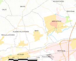
| Confin | Baixas, Saint-Estève, Perpignan, Le Soler e Villeneuve-la-Rivière | ||||
| Fus orari | UTC+01:00 e UTC+02:00 | ||||
| Varie | |||||
| Codex postal | 66540 | ||||
| Codex INSEE | 66012 | ||||
| Localizazion | |||||
 | |||||
| Sit istituzional | |||||
Baho l'è 'n cümü fransés de la regiù Languedoc-Roussillon, endèla Frància meridiunàla. El fa part del cantù de Saint-Estève, del circondàre (arrondissement) de Perpignan e del dipartimènt dei Pirenèi Orientài.
El g'ha 'na popolasiù de 3 252 abitàncc[1], dato agiurnàt al sginer 2011.
El sò teretóre el g'ha 'na superfìce de 7,90 km² e 'l và de 'na altèsa mìnima de 34 méter a 'na altèsa màsima de 90 méter söl leèl del mar.

| Sindech | Period |
|---|---|
| Antoine Morat[2] | ? - 1815 |
| François Sauret fils[2] | 1815 - ? |
| Guy Casadevall | 1983 - 2008 |
| Patrick Got | 2008 - |
L'andamènt del nömer dei abitàncc del cümü de Baho l'è ilüstràt endèla tabèla riportàda ché sóta:
Abitancc censicc
