Type a search term to find related articles by LIMS subject matter experts gathered from the most trusted and dynamic collaboration tools in the laboratory informatics industry.
Township of Marrs Hill | |
|---|---|
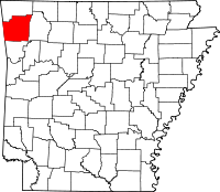
 Location of Marrs Hill Township in Washington County | |
 Location of Washington County in Arkansas | |
| Coordinates: 36°2′15″N 94°20′21″W / 36.03750°N 94.33917°W | |
| Country | |
| State | |
| County | Washington |
| Established | before 1850 |
| Area | |
• Total | 20.6 sq mi (53 km2) |
| • Land | 20.6 sq mi (53 km2) |
| • Water | 0.0 sq mi (0 km2) 0% |
| Elevation | 1,106 ft (337 m) |
| Population (2000) | |
• Total | 898 |
| • Density | 44/sq mi (17/km2) |
| Time zone | UTC-6 (CST) |
| • Summer (DST) | UTC-5 (CDT) |
| Area code | 479 |
| GNIS feature ID | 69795[1] |
Marrs Hill Township (formerly Mars Hill, Mar Hill, and Marr's Hill) is one of thirty-seven townships in Washington County, Arkansas, United States.[2] As of the 2000 census, its total population was 898.
According to the United States Census Bureau, Marrs Hill Township covers an area of 20.6 square miles (53 km2); all land.[2]
The township contains Bell Cemetery and Rose Cemetery.
The township contains no state highways.